

By Carol Tannenhauser
The Question: “I’ll never quite understand how district borders are determined,” a reader wrote to West Side Rag.
The Answer: Redistricting.
Why is it so important? Because redistricting — the determination of new electoral district borders — can have a profound, even predictive effect on the outcome of elections. Indeed, according to The New York Times, “Redistricting could flip control of the House in 2022 without a single voter switching sides.”
All 50 states are now in the process of redistricting. Here’s how it works.
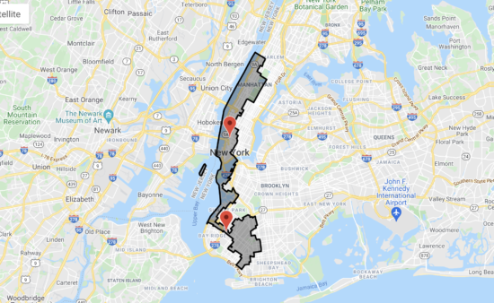
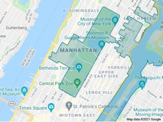
A district is an area where you live, vote, and, presumably, are represented. We all reside simultaneously in several different districts. In addition to Community Board 7 (which is appointed by elected officials) and City Council District 6 (council terms are shortened to two years during redistricting), most Upper West Siders reside in U.S. Congressional District 10, State Senate District 29, and State Assembly District 67. All of these have their own distinct borders.

Every ten years, after a national census, as was completed in 2020, all district borders in all 50 states are redrawn, based on changes in population and federal guidelines. Essentially, the districts must be roughly equal in population, contiguous and compact, take into account “likeness of community,” and not discriminate on the basis of party, race, or ethnicity.
As in many states, New York’s district borders were redrawn by state legislatures until 2014, when, to make the process fairer, New Yorkers voted to appoint an independent commission to redraw district lines. They are in the process of doing so, and will release new maps on September 15th.
“After a series of (virtual) public hearings this summer and fall, the commission will submit its proposed maps to the Legislature, which can either approve the lines or reject and ultimately redraw them,” Gotham Gazette reported.
What’s the point of an independent commission then? Primarily, it’s bipartisan, appointed by all four majority and minority legislative leaders, with a better chance of avoiding the bugaboo of redistricting: gerrymandering.
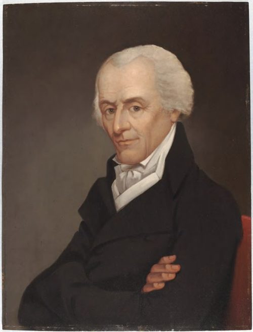
“Gerrymandering was named after early 19th-century Massachusetts Gov. Elbridge Gerry,” Vox explained. “After Gerry took office in 1810, his Democratic-Republican party redrew the map of the state’s Senate districts in a particularly dramatic and unusual manner. The aim was to weaken the opposing Federalist Party as much as possible. The new map of the state’s Senate districts was widely mocked in the press…. One strangely shaped district was said to look like a salamander, and was combined with the governor’s name to create the term gerrymander.”
Merriam-Webster defines gerrymandering as “the practice of dividing or arranging a territorial unit into election districts in a way that gives one political party an unfair advantage in elections.” It goes on to describe two methods of gerrymandering: “cracking” and “packing.”
“Cracking is a form of gerrymandering in which election districts are drawn in such a way that voters likely to support the opposing party are spread among multiple districts to dilute the power of their votes. Packing is a form of gerrymandering in which election districts are drawn in such a way that voters likely to support the opposing party are concentrated into a single district to limit the influence of their votes in other districts.”
“New York State currently has 27 members in the U.S. House of Representatives, 63 state Senate districts and 150 Assembly districts,” THE CITY reported. “But New York will be losing one seat in Congress based on the statewide population count already released by the Census, in which New York fell 89 people short. In a political game of musical chairs, New York’s redistricting players will decide which seat will be eliminated — likely a Republican-held district upstate, given the Democratic party’s domination of the process.”
New York does not reflect the majority of the nation. Although the U.S. Congress is split, in terms of state legislatures, “as of July 30, 2021, Republicans controlled 54.31% of all state legislative seats nationally, while Democrats held 44.83%. Republicans held a majority in 61 chambers, and Democrats held the majority in 37 chambers. One chamber (Alaska House) was organized under a multipartisan, power-sharing coalition,” Ballotpedia reported. This is significant, because “in 33 states, state legislatures play the dominant role in (congressional and) state legislative redistricting.”
Gotham Gazette explained what’s at stake, “The Republicans have more power over drawing new state district maps than the Democrats do because they have more “trifectas,” where one party controls both houses of the state legislature and the governor’s office. The Republicans now have 23 states with trifectas compared to 15 for the Democrats, including New York. These national Republican advantages mean the outcome of redistricting in New York could be vital to the Democrats holding the House of Representatives.”
There is a point in the redistricting process when the public can weigh in and affect how lines are drawn. Before you assume that public hearings carry no weight, the Brennan Center for Justice reported that “about 44 percent of public comments that expressed a view on how a specific location should be handled by map drawers were adopted in the final congressional maps.
“Following the virtual hearings and the release of the official census data the commission will release the first redistricting proposal to the public on September 15. The commission will then schedule the constitutionally required hearings for additional public input on the proposed map in the fall.” For guidance about making effective redistricting comments at a hearing, click here.
The article above was sent to us by Upper West Sider Carol Salmanson. Salmanson is an artist and member of True Democracy NY, a nonprofit organization whose mission is “to get fair electoral district maps drawn this year, because they will determine which representatives are ours for the next ten years,” she said. “True Democracy’s goal is to make voters aware of the power they have to influence these maps and thereby strengthen our voice.”
When the schedule for the fall public hearings is released, we’ll let you know.


Drawing truly compact and contiguous districts is very easy with modern computing technology. In an ideal world, each person would be entered without any tags as to age, gender, race, voting history, etc. Then the software works its magic.
Unfortunately, both parties have abused the system, with Republicans generally more guilty but Dems are not innocent either.
Also unfortunately, the courts don’t really care so it largely continues, with the occasional slap on the wrist.
It’s not that the courts don’t care. It’s that the courts like the Rs and Ds, lawyers and Congress are captured by the Act of 1871 and therefore, so are We The People.
Look up the Act of 1871 and you will begin to understand the last 150 years of our misery and more recently our disappearing middle class.
The Act of 1871 was ushered through and signed by our 18th President Ulysses S. Grant which in effect sold us back to the British and turned DC into a corporation.
You never learned about the Act of 1871 because it has been excluded from our Civics classes and Law Schools!
Truth Teacher, can you explain that more specifically?
Bravo to Truth Teacher.
I would add:
We the People are free from enslavement, victimhood and misery when we remember our Unalienable Rights memorialized in our Declaration of Independence:
We hold these truths to be self-evident, that all men are created equal, that they are endowed by their Creator with certain unalienable Rights, that among these are Life, Liberty and the pursuit of Happiness.–That to secure these rights, Governments are instituted among Men, deriving their just powers from the consent of the governed….
Regardless of how the new district will look like, borders wise, we MUST remember that some of our elected people are lifers who have been in the system for well over 20 years, and it’s time to do our share for term limits by voting them out.
Younger & newer blood is always a positive.
As the person who made the original comment, thank you much for so thoughtfully providing a balanced history and explanation. I appreciate it and expect so many others do as well.
Thanks for raising this topic!
Ten years ago, during the last redistricting, two or three blocks between Amsterdam and Morningside Drive were moved out of State Assembly District 69 to District 70. This move may have been designed to even the numbers of constituents in these districts but it took residents out of the Morningside Heights’ member’s sphere of representation and into the district of a less interested member of the Assembly.
Hey local Democratic club members! Can you advocate on behalf of switching these blocks back? And, although this may be a bit out of the neighborhood for WSR, while we are talking politics, who are the folks standing up to replace Brian Benjamin in State Senate District 30 and what are Democratic leaders Keith Wright ( Manhattan) and Jay Jacobs ( New York State) saying?
Many thanks for this – at long last – clear explanation of a vital aspect of our lives.
Thanks for this excellent article and for mentioning the work of our group, True Democracy NY (not True Democracy Now) and the #DrawDemocracy campaign, which is a partnership with Represent.Us NYC. Reach out to us at http://www.drawdemocracy.org and follow us on Twitter and Instagram at drawedemocracyny.
Name changed!
i really am out of it today. Mondays! Social is at DrawDemocracyNY
Sorry, I meant at truedemocracyny for social.
Thank you for all the research and hard work it took to get a strong grasp on the complicated topic that impacts all of our lives…and then to communicate it clearly. No mean feat!