
 By Rob Garber for the Bloomingdale Neighborhood History Group
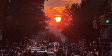
Welcome to another installment in the Rag’s Historical Photo Challenge. The image above was taken somewhere on the Upper West Side, sometime in the past. Can you figure out where, when, and what it shows? Look closely; this week’s challenge photo, like the others in the series, includes clues that will help you identify the scene, if you’re a dedicated UWS history sleuth. And even if you don’t recognize the picture—not to worry! Come back in two weeks and I’ll decode it, show you the clues that help identify it, and—best of all—tell you a story the image unlocks, because this column isn’t just a test of your neighborhood knowledge; it’s also a rolling celebration of the people, buildings and events that wove the tapestry of the Upper West Side.
Ready? If you think you know where and when the photo was taken and what it shows, post your answer as a comment on this column.
Solution to Historical Photo Challenge #3
Subject: The UWS transitioning to the automobile era
Location: East side of Broadway, looking north from West 109th Street
Date: March 23, 1910
Image Source: New-York Historical
Shoutout to readers: You guys are good and getting better every week! Now you’re using the IBDB database and Tom Miller’s excellent social histories at the Landmarkwest! website. Pretty impressive. Lisa B was the first to get it right, though she later questioned her own correct solution. Paul noted the background building further north as a clue; Glen Weisberg made a good guess on the date by observing the mix of cars and horses as well as clothing styles. Debbie Socolar was the IBDB sleuth who nailed the date based on the brief run of a play advertised in the image. Ira Finkelstein gets a hat tip for tossing in a New York rat story.
Clues: The foreground building with the rounded corner still stands on the northeast corner of Broadway at 109th Street, largely intact starting with the second floor. Its strikingly dark cornice was happily never removed, in contrast with the window pediments, which have been replaced with featureless blocks except on the highest floor.

The rest of the story: The beauty of this photo begins with what it doesn’t show—no Grant’s Tomb, no St. John the Divine or Ansonia. It’s an ordinary turn-of-the-century Broadway street scene, but the closer you look the more you can see. Here are three stories that emerge from this apparently unremarkable photograph:
1. The transition from the horse to the automobile. It is scarcely possible to imagine the degree to which urban life revolved around the horse as the 20th century began. Stables, food supplies, manure disposal! Farriers, carriage makers, saddlers! When the automobile and the truck arrived, they displaced horses as well as the vast industry that supported them—but not overnight. Well into the 1920s and even the 1930s, horses remained a common sight on New York City Streets. This photo shows three horses—or rather, shows three wagons from behind, plus horses’ legs. This is how horses persisted the longest in Manhattan—pulling humble wagons that delivered milk, produce, beer. In the foreground is the future: an automobile, also seen from the rear with its unprotected gas tank(s) attached in back. It may well have been a Pullman Automobile, because it’s parked in front of a Pullman showroom. Pullman was a relatively short-lived (1903-1917) car manufacturer in York, Pa.

2. The arrival of the subway. The splendid entrance to the subway on the southeast corner of 110th and Broadway that can be seen in the photo was one of the original kiosks that adorned IRT stations in 1904. When this picture was taken, the subway had only been at 110th Street for five years. New York’s kiosks were modeled on those designed for the Budapest subway system, which was a few years older than New York’s. The architectural firm of Heins & La Farge designed the kiosks, which took their name from the Hungarian word for “palace” or “pavilion”—kioszk. The 110th Street kiosk was removed in 1925 because it interfered with the ability of pedestrians trying to cross Broadway to see and be seen by drivers.

3. Theater history. The two-story building in the center background of our mystery photo, occupying the southeast corner of Broadway at 110th Street, holds a place in the history of 20th-century theater. It was built in the 1890s as the Lion Palace, a combination music hall, bowling alley and saloon for the nearby Lion Brewery at 107th and Columbus. As the Lion Palace, it hosted vaudeville shows, boxing matches, even bicycle races. On its stage in March 1901, Maurice Barrymore, patriarch of the great acting family, startled his audience by suddenly breaking into a virulent antisemitic rant. He was sent to Bellevue, diagnosed with syphilis, and never recovered. In 1906, the Lion Palace was renovated and became a “stock theater,” opening with The Prisoner of Zenda. It had a roof garden that could be used as an ice-skating rink in the winter. In 1910, theater entrepreneur William Fox bought the Lion Palace and converted it to a large theater that seated 1,100. Our mystery photo captured the 1910 transition, with the front of the building covered by a large poster advertising the short-lived Broadway comedy Where There’s a Will. Renaming it the Nemo Theater, Fox originally used it for variety acts but as motion pictures displaced vaudeville, Fox added the Nemo to his stable of movie houses. The Nemo added another footnote to theater history in 1926, when it was used as a venue to test an experimental sound technology. Fox was persuaded, and the technology, trademarked Movietone, became dominant as movies added sound. The Nemo lasted as a movie theater until the early 1960s, when it closed and was replaced by a Daitch-Shopwell supermarket. The building itself stood until 2002.

…and that’s the story behind the mystery image. Now scroll back to the top of the column and take on your next challenge, Sherlockians! If you’ve missed any pictures in this series, here is the complete collection. About the author: Rob Garber has lived on the Upper West Side since the late 20th century and is a member of the Bloomingdale Neighborhood History Group. To learn more, visit their website at upperwestsidehistory.org. All photos in Upper West Side Historical Photo Challenge are used by permission.
Subscribe to West Side Rag’s FREE email newsletter here. And you can Support the Rag here.


Ft. Washington area
Aeromarine Airways airport, Hudson River neat 82nd street
Well done.
https://www.timetableimages.com/ttimages/aeromnyc.htm
This is the Sea Plane base at 82nd Street c.1920s
Aeromarine Airport, 82nd Street and the Hudson River, 1920
Central Park boathouse
Historic Columbia Yacht Club at the end of W 86th St. Time – about 1930? Is that a seaplane on the river?
Columbia Yacht Club, which also had seaplanes – see website for an old postcard view.
Location of street level is 86/RSD (the buildings south are still there, those north were replaced by the Normandy apartments), 1920s?
The Columbia Yacht Club at the foot of W 86th St. Robert Moses evicted them in 1934, as Robert Caro recounts in The Power Broker.
That two tone building on 86th and RSD is still there
I tried looking for a picture of this when I read the book! I think you’re right!!
It looks like the corner of 137th and RSD?
This appears to be north of where the Harlem line originating at Penn Station emerges from the tunnel, running northward along the Hudson River. There are two long trains running in opposite directions in the background of this photo. I hope that is helpful to whoever solves the puzzle.
Uws is 72nd to 86. Even into the 90s that was the definition. Realtors pushed it back. 109 is not uws it is morningside heights.
Aa amazing amount of history in just one seemingly mundane photo. Thanks, Rob!
You guys are right. It’s the Aeromarine airport next to the Columbia yacht club in the 1920s
Love the detailed discussion of the “solution.”
I believe the large building on the right is the Dorchester (131 RSD spanning 85th to 86th Street), where William Randolph Hearst once occupied the penthouse. A postcard from about 1910 shows the clubhouse and dock of the Columbia Yacht Club, constructed in 1874 at 86th Street. This photo shows an expanded dock and a second structure, dating it to sometime after 1928, when the New York Yacht Club is reported to have shared the premises.
How did one access this facility from the land side — i.e., how did you get across the train tracks? Did you just have to walk across the tracks? Or was there some way to go over the tracks out of the frame of this picture to the north or the south?
This may have been after Moses demolished the access to the yacht club as part of his not so passive-aggressive plan to get rid of it altogether in pursuit of his Westside Highway/Riverside Park plans.
Aeromarine Airways foot of 82nd and Riverside.
79th Street and Riverside Drive.
This looks like facing East over Riverside Drive – between West 85th and 87th Street. The two buildings on the left are 131 and 137 RSD. – built by about 1910 or thereabouts. The wide street to the left of 137 RSD is West 86th St.. This photo was taken before the Normandy was built (1937?) and before the Senior citizens home on the N side of 87th St was built (1925?). It was also taken before Robert Moses extended the park to cover the tracks of the Railroad. I suspect it was taken between 1915 and 1922.
my guess: Boat house on the Hudson…maybe 1930s. Perhaps near Spuyten Duyvil where I once read there was one. Likely connected to Columbias rowing teams.
Riverside drive 96st
Columbia Boathouse from when crew races were held in the hudson. They then moved to inwood where baker campus is.
Oh I forgot to mention it’s at 116th street
Hi Rob, Another fascinating puzzle.
The aerial picture obviously shows the Hudson River and the uncovered West Side rail line, with two passing trains to boot. My main clues for the location however were the two prototypical UWS apartment buildings along Riverside Drive. Although there are a lot of candidates along the drive that look similar, two buildings, lot line to lot line, one with an ornate entrance along the drive and the other with the entrance around the corner, can only be seen from 85th to 86th St. (Thank you Google Earth!)
In the foreground of the picture we can see the beginnings of the Robert Moses extension of Riverside Park over the tracks and out into the waters of the Hudson engulfing a rather attractive building. Several maps on the NYPL website show a pier at 86th St., and one of them (from around 1908?) conveniently labels the pier as the Columbia Yacht Club. A picture postcard from 1904 captioned Riverside Drive and Columbia Yacht Club, New York, shows the main building from the photo, although not the pavilion to the north.
Finally, the New York Times, on July 2, 1934, dutifully reported that demolition of the building was to proceed on that very day. Since the leaves are not out on the park trees in the photo, the scene was probably taken in the early months of 1934.
Location: Riverside Drive from 87th St to 85th St., pathways in the park, the West Side rail lines and the Columbia Yacht Club.
Date: The early months of 1934.
The cross street is 86th at Riverside Drive. The row of townhouses on the left are 140-147 Riverside Dr replaced in 1939 by The Normandy apartment building (Emory Roth). The two buildings to the right still exist. 137 RSD The Clarendon was owned at one time by WR Hearst and where Marian Davies the actress lived.