
By Yvonne Vávra
I went to West 96th Street to find some calm. There’s a green stretch and a winding path, a little brook babbling its way toward the Hudson. A woman in a long skirt, with a boy and a dog in tow, is about to cross what can only generously be called a bridge. She may want to reconsider. And that dog might actually be a goat. Honestly, they could all just jump to the other side and be safer for it.
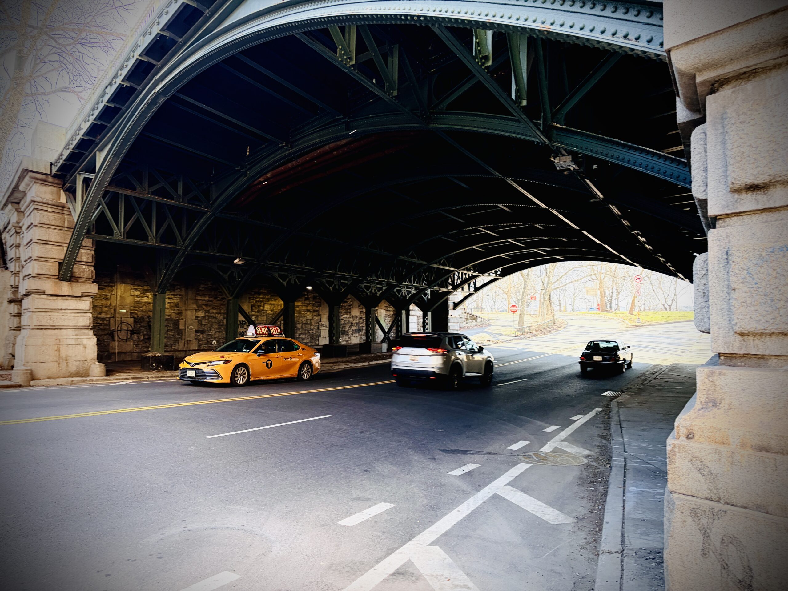
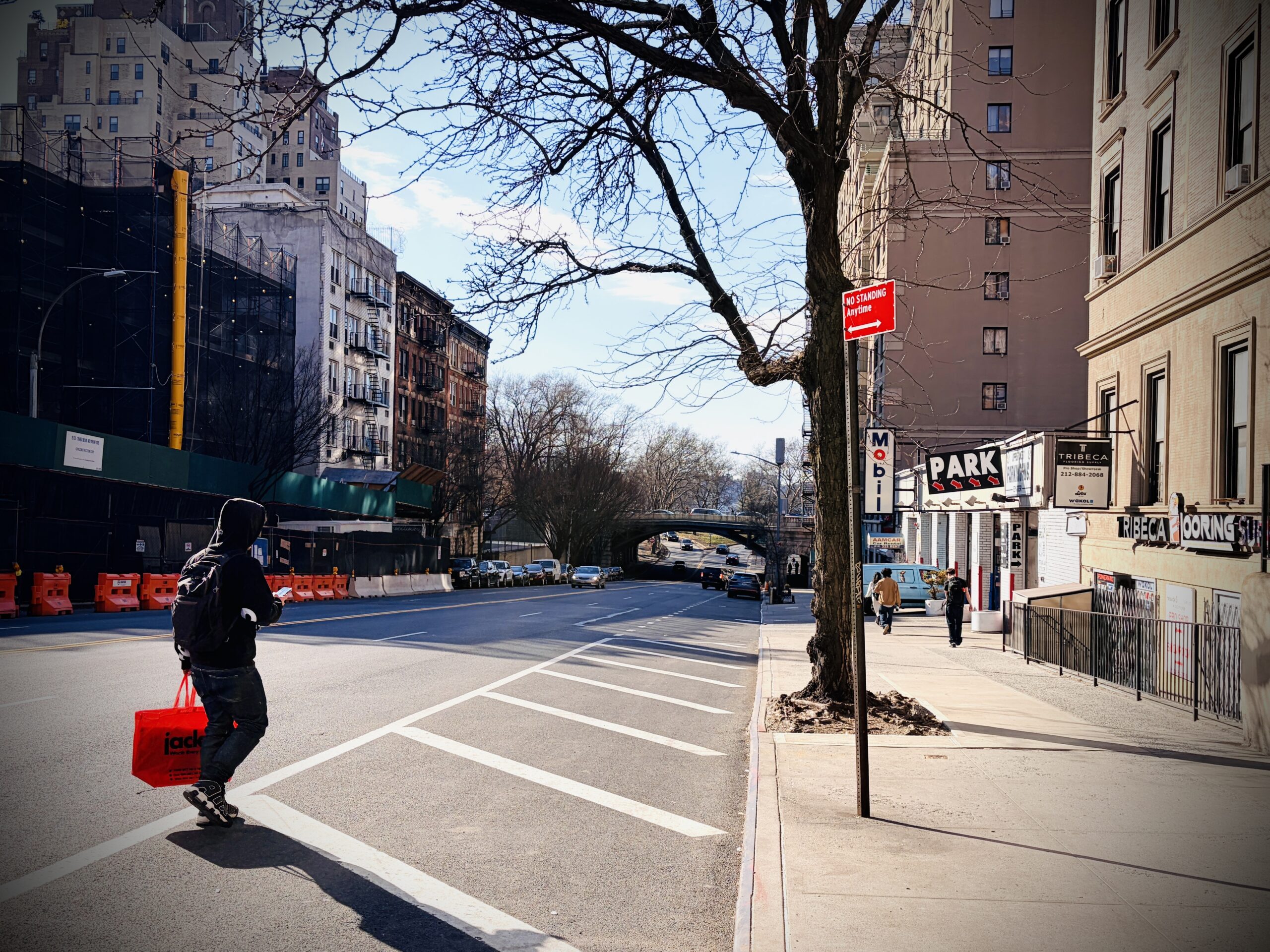
This is not today’s 96th Street, oh no. On today’s 96th Street, there’s a Mobil gas station to my right and a large construction site to my left, and I’ve missed my chance to cross at the lights on West End Avenue. Cars rush onto the Henry Hudson Parkway from city traffic, while others suddenly appear off it from behind a bend I can’t see past. So I’m stuck here for a while, on this in-between block, where the charming Upper West Side gives way to whatever the highway is roaring about. Plenty of time to imagine the oasis I came here for, inspired by a painting by William Rickarby Miller from 1869.
 Miller’s little brook was no pipe dream. Old maps show that this stretch of 96th Street was indeed once a stream. They also show that the Hudson shoreline here was not always as straight as it is today. There was a sizable indentation that gave the village of Strycker’s Bay its name—which is also the title of Miller’s painting.
The land was owned by the Strycker family, who had already acquired property on the island by the mid-17th century. In “Hidden Waters of New York City”, Sergey Kadinsky writes that the first Strycker family member arrived from the Dutch city of Haarlem, near Amsterdam, in 1640, and built a life farming the land and trading furs with the Lenape. And because any mention of the Lenape sends me down a research rabbit hole, I now know that our little loudmouthed 96th Street was once—long before the city became the city—a rather rare and special place.
Back then, our part of the island was far from the prime real estate it is today. The Native Americans of Mannahatta did not occupy much of the island’s middle section, especially on the west side, likely because of its rugged terrain. In his 1922 book, “Indian Paths in the Great Metropolis”, Reginald Pelham Bolton writes: “It was rocky throughout, with a scanty deposit of soil, the hollows insufficiently drained, and therefore boggy.” We’ve come a long way, huh? Bolton goes on: “But the main objection, from an Indian point of view, lay in the exposure of the west side of the island to the bitter wintry winds.” Now that, I can relate to.
However, there was at least one favorable spot in this otherwise rough terrain: Strycker’s Bay with its freshwater spring—our little 96th Street brook. Bolton notes that oyster shell middens have been discovered here, clear evidence of Native American habitation.
The 96th Street stream was by no means the only one. The island was once overflowing with them. In what is now the Upper West Side, Milkman Spring ran along Broadway at West 61st and 62nd streets; Saw Kill flowed from around West 85th Street south along Columbus through the site of the American Museum of Natural History; and Montayne’s Rivulet ran from West 95th and Columbus into the park at 101st Street and up toward what is now the Davis Center. It’s one of two still-active springs in Central Park.
The other is Tanner’s Spring, north of 82nd Street near Summit Rock. It’s named after Dr. Henry S. Tanner, a passionate advocate of fasting for better health. In 1880, he turned himself into a public spectacle by going without food for 40 days, sustained only by water from Tanner’s Spring. After his stunt, New Yorkers from all over the city came to Central Park to fill their bottles with its supposed healing waters.
We know how things ended for our unnamed brook at 96th Street. The Hudson River Railroad was built in 1846, the bay was filled in during the 1860s, and the viaduct lifting Riverside Drive over the old, now-concrete valley followed in 1900. Then came Robert Moses, who finished the job with the highway in the 1930s. Still, we got a larger Riverside Park out of it—132 acres of new recreational space. Sliced by a highway, sure. But more is more.
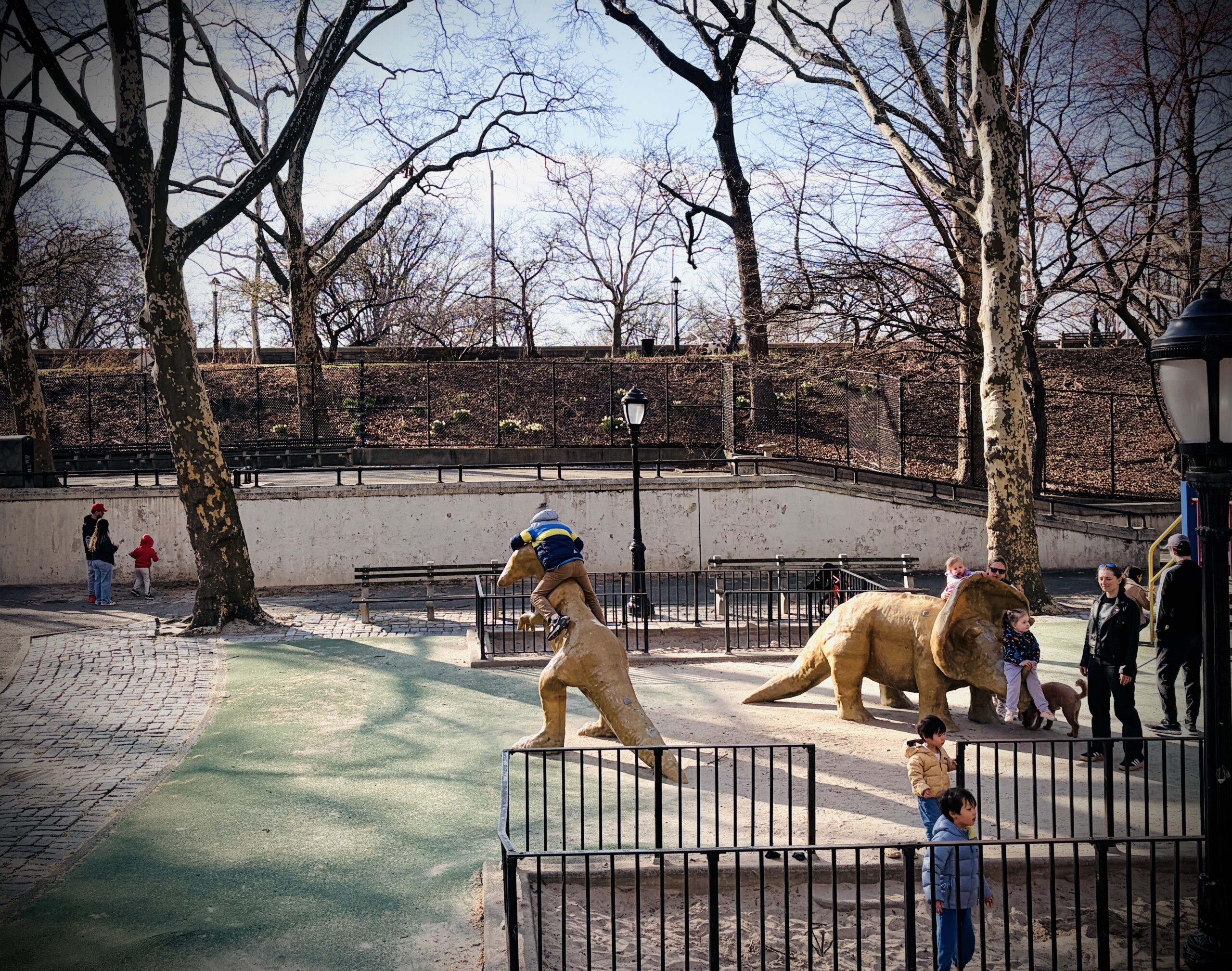 Surrounded by the vroom of the cars, I watch a boy conquer a dinosaur on the playground by the highway. Maybe this is where Miller’s long-skirted woman considered taking on the rickety bridge. It’s now where I tackle the highway, navigating its mood as I move through tunnels and detours, until I reach the river. The idyll is still here, beautiful enough to block out the noise of the traffic above. The Hudson sparkles, ducks are cackling, runners are shaking off the day, and two seniors are cuddling on a bench. It’s not the 1869 kind of pastoral calm, but exactly the kind I was looking for.
Subscribe to West Side Rag’s FREE email newsletter here. And you can Support the Rag here.


pepperridge farms remembers. I remember when 96 and b’way wasn’t overrun with vagrants and fast food joints.
tales like this are cute and fun but pissing and moaning over how things have changed serves no purpose because those days have past and will not return.
the simple fix for navigating that crossing is to go a block either north or south and the park can be easily accessed.
I think you’ve quite missed the point of this little essay; it is indeed positive:
“ The idyll is still here, beautiful enough to block out the noise of the traffic above. The Hudson sparkles, ducks are cackling, runners are shaking off the day, and two seniors are cuddling on a bench. It’s not the 1869 kind of pastoral calm, but exactly the kind I was looking for.”
As a fun added anecdote – the poem “Woodsman Spare that Tree” – which became a popular song prior to the Civil War – takes place here. The tree in question would’ve been located around 97th–ish Street, where the Main Drive and RSP connect
I love this section of the park, it’s one of my regular spots. Between Dinosaur Playground and about 110th.
Yeah, it barely resembles the peaceful babbling brook of days long gone, but trees, grass, families, athletes, happy kids, friendly dogs, river breeze… it’s just a wonderful area. And I’m looking forward to both the Ellington and the Ecuadorian cart opening for the season.
However, why can’t they pave the entrance and exit?? It’s been crap for years. The city says it’s the state road and the state says it’s the city problem. So nothing gets done.
Don’t get me started on the road “Little RSD” from 97th to 104th. Having seen new pictures of the moon it seems the moon has less craters!!
An excellent column and I appreciate the research. We walk this stretch of Riverside daily with the doggo, and it’s fun to have this imagery of what once was.
Next time bring the goat!
Why is there a dog in the Dino playground? Dogs are not allowed and there are signs everywhere. Dog owners continue to be the most inconsiderate scofflaws on the UWS.
Why not have sweet dogs there? Kids love them.
1. Not all kids love dogs. 2. People cannot control where their dogs urinate or defecate as evidenced by our streets. 3. Everyone thinks their dog is cute, sweet, well behaved etc until they bite someone. 4. Somepeople are allergic to dogs
All of the above and more are why there are laws regarding dogs and why there are signs clearly posted at the entrance to the playground.
Kids deserve a safe place to play where the sandboxes and sprinklers havent been used as a dog toilet. Take your dog to the dog park
Not everyone does, and maybe it’s nice to have an oasis for people with allergies, unsteady on their feet, or just afraid after an attack.
Ever seen an ebike rider?
What a lovely essay! I learned something about a street I walk on every day but never really considered. Nice job finding the beauty.
Sadly, there is no peace and quiet on the UWS. Con Ed comes out and digs a trench and covers it with poorly laid down steel planks that sound like thunder every time a car goes over it. Then, mystifyingly, Con Ed comes out finishes whatever they were digging only to come back a week later and dig it all up again…….on the weekend or midnight, because presumably there isn’t any traffic…….but, there are hundreds of work weary people who are trying to sleep. But, I guess as long as Con Ed can pay overtime, we have no voice. I work in public relations and if they were my client, I would advise them to post notices in every building which might be affected by their jack hammering and say, at the very least, “we are so sorry for the inconvenience but there is a gas line running under your street that might cause an explosion.” That is rarely the case.
This isn’t about any article but please write one to warn dog owners and walkers about the danger of dogs eating weed that’s discarded when smokers throw them to the sidewalk. My friend’s dachshund has been taken to the emergency vet three times already. The first time the pot had been laced with fentanyl and he almost died. Thanks
I am the dachshund owner in question! Marijuana toxicity is a serious problem
For small dogs. Full-blown convulsions, accelerated heart rate, etc. At Blue Pearl, where I took my dog because he always managed to scarf down the discarded weed when it was dark, I couldn’t see it, and he get was closed, I was told that since marijuana was legalized there hasn’t been a single day without a dog or dogs coming in for marijuana toxicity.. I’m in favor of the legalization, but I wish that smokers would not leave their detritus on the sidewalk. I know a great many dog owners and almost none of them had ever heard it.
Thank you for posting.
There are a few places in Central Park that are truly “off the beaten paths” – so much so that when I go to them, I rarely see anyone else. And they are all truly serene, almost idyllic, settings. One even has a waterfall (I kid you not). I go to one or another of these places during warm weather when I REALLY want to be alone or just truly calm. Don’t ask me to give you directions; I couldn’t do it even if I wanted to because I simply know my way to them through rarely untraveled bush and brush.
There are two waterfalls along the ravine in the North Woods at around 104th st, one in the Ramble near the western side of the Park Drive at maybe 77th st or so, and one at the southern end of the park along a path running north-south at about 6th ave. Nothing is untraveled in Central Park of course, but I go to the Ravine for the illusion of being somewhere else, relative quiet, and nice birds. I recommend it!
“They paved paradise, and put up a parking lot…” (Joni Mitchell)
Many of those streams are still underground on the UWS and sometimes end up in apartment building basements.
The stream across W 96th St. near CPW (Montayne’s Rivulet?) seems to have slowed construction of the fancy new bldg at 15 W 96. That construction took many many months to deal with what looked like a river running through the deep foundation hole, pumping the water out to the NYC sewers while puzzling out what to do. Don’t know how they solved it because they put up green panels that blocked seeing the solution. It was interesting to watch while I could see it. Spoiler alert–I could be wrong about what I was seeing. It’s my own explanation about it.
Sometimes they hit unexpected water mains, too. Back in my youth (1975) I had a summer job at the Metropolitan Museum (typing, I was no arts wunderkind). They were digging to put in the Temple of Dendur building when a huge kerfuffle ran all through the place. Turned out they had hit an old water main that City records showed to be unused – maybe running to the old reservoir at 42nd St? The entire hole filled with water rather quickly. No one was hurt, though I think they lost some equipment. A huge hassle, of course, but I remember being very amused indeed. Oh, dear, what does it say about me that I still am? Gotta be careful when you dig up the past, whether it’s millenia old or just centuries!
That’s why there’s been a push to create a comprehensive, digital uber-map of subterranean Manhattan, consolidating every utility’s maps of their buried services; all of the MTA’s tunnels and accessways; building basements, subbasements, and private passageways; etc.
Obviously one major concern is security, since such a map couldn’t ever be public. But it could be a great resource for anyone planning a legitimate, authorized spelunking mission beneath the isle’s streets or sidewalks. (Assuming it could ever be anything approaching accurate, which I kind of doubt.)
Thanks for another beautifully written piece, Yvonne. Always enjoy reading your interesting and insightful observations (meditations?) of our neighborhood. What a terrific old map you found … fascinating to compare then vs. now.
Thank you Yvonne for another delightful NYC essay. I am a decades long resident of 96 St and am fascinated to learn of its geologic and Indian lore. I love Riverside Park!
Strycker’s Bay is supposedly the location for George Pope Morris’s 183 7 poem Woodman, Spare that Tree. One of the first environmentalist poems, and later famous, as in this rendition by Phil Harris, https://www.youtube.com/watch?v=jSxOEd0d4Ls Also interesting as a for domestic relations.
Thank you Yvonne for a wonderful article. It almost reminds me of Time and Again by Jack Finney, practically my favorite book.
I like to imagine the sounds from the West Side Highway are ocean waves breaking on the shoreline. And I recommend these 3 places for a feel of “real shoreline”: north of 96th Street sitting on the rocks, near 63rd Street, and 60th Street. At low tide, there is an actual beach.
There is still an under ground stream along 96th Street according to construction workers who know by working in the basements
Fascinating article. THanks for the info.